- The Digital Archives Top
- Important Cultural Properties - Classic Maps
- Genroku Kuniezu
- Shimousa-no-Kuni (Genroku era)
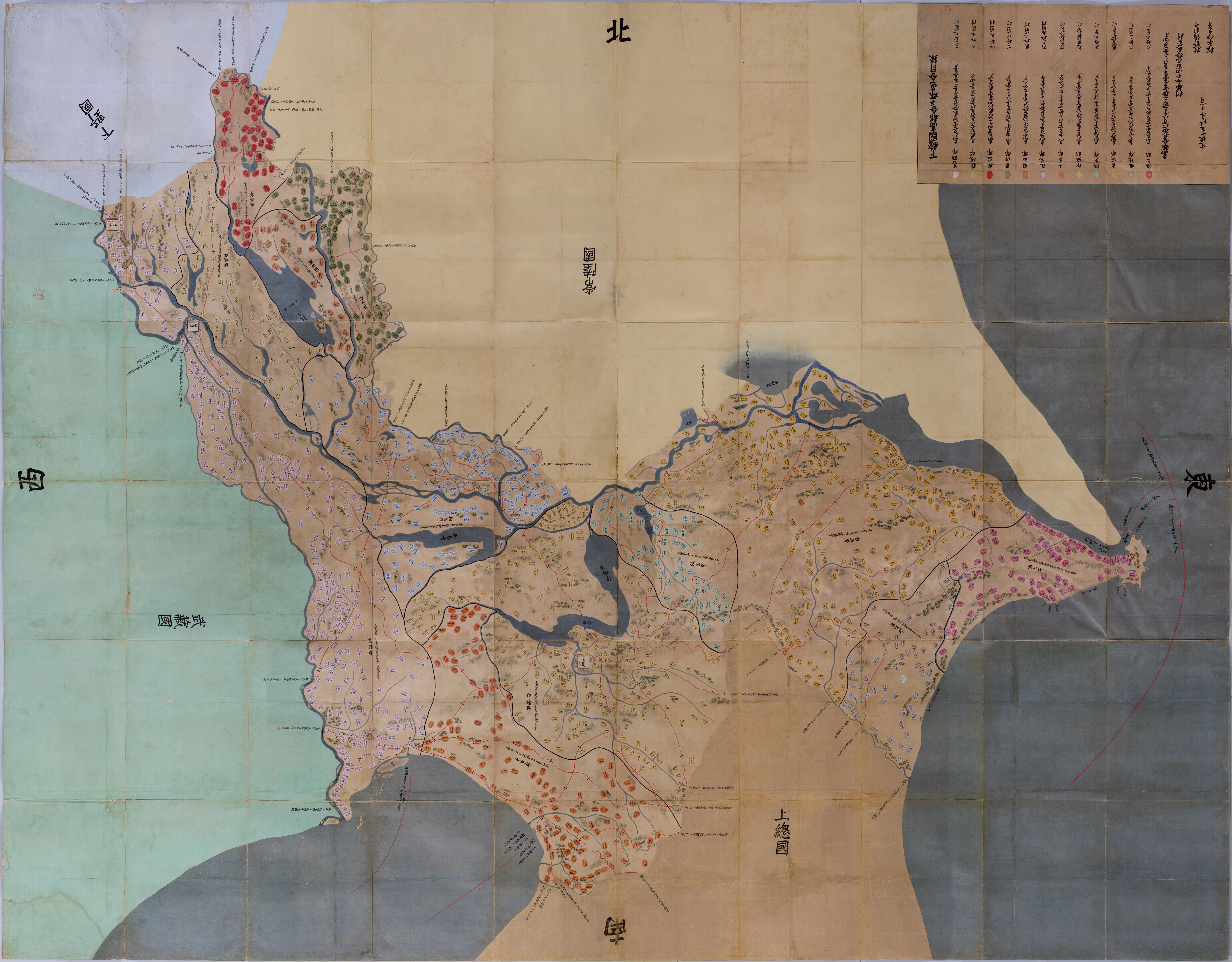
Shimousa-no-Kuni (Genroku era)
The Tokugawa Shogunate ordered four times in years of Keicho, Shoho, Genroku and Tempo to prepare maps of every "kuni" (country) all over Japan. Preparation of Genroku Kuni Ezu (national land maps) was ordered to be started in the 9th year of Genroku (1696) and completed to cover most of Japan by the 15th year of Genroku (1702). The maps were compiled on a scale reducing 1 "ri" (3927m) to 6 "sun" (18cm) [about 1/21,600 scale], containing mountains, rivers, roads and other landmarks. Black circles across highways are milestones. Names of villages and recognized yields of rice are written inside oval frames that are colored differently for individual counties, while castle towns shown by white squares indicate names of area and lords of castle. The National Archives possess 8 each originals and copies of the Genroku Kuni Ezu. These maps were designated as National Important Cultural Properties of Japan in the 58th year of Showa (1983) together with 83 maps compiled in Tempo era (119 maps when overlapped portions are included) and 85 Tempo Go Cho (records of villages) where a yield of rice of every village from Matsumae (Hokkaido) to Ryukyu (Okinawa) The photography was carried out without any modification of the present conditions of the maps, and some of the portions may not be so clear.
Names filled in shows that Sekijuku domain (Makino Bizen-no-kami) and Koga domain (Matsudaira Izu-no-kami) were tasked to prepare illustration. Development of new rice field was in progress and a lake called Tsubaki Sea was reclaimed and disappeared.
Original size: 501cm from east to west and 391cm from north to south.
二次利用について:
ただし、画像については「画像等データの二次利用について」をご確認ください。