- The Digital Archives Top
- Important Cultural Properties - Japanese Classics
- Mamiya Rinzo Kitaezo Kembun Kiroku
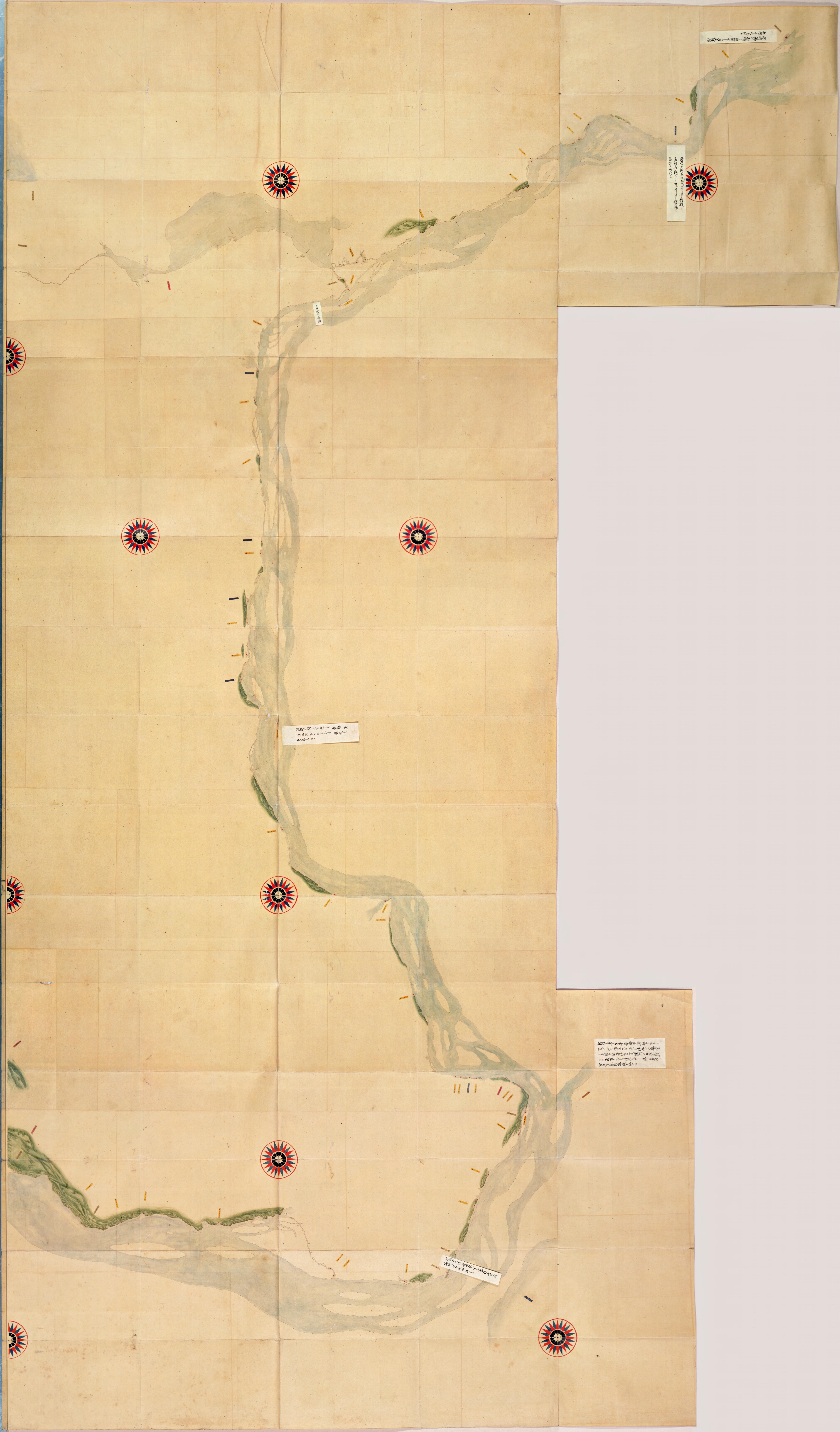
- Kitaezotouchizu
- Totatsu chiz
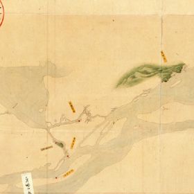
Totatsu chiz
On order of Tokugawa Shogunate, Mamiya Rinzo (1775 - 1844) coasted west coast of Karafuto (Sakhalin) in 5th and 6th year of Bunka (1808 and 1809), discovering that Karafuto was an island (discovery of Mamiya Strait) and surveyed as far as Todatsu area in the downstream of Amor River (Heilongjiang). Kitaezo-to (North Sakhalin Island) maps in scale of 1/36,000 show details of the coasts of Karafuto and was presented to Tokugawa Shogunate in 8th year of Bunka (1811). Sailing routes are shown by red dotted lines, illustrating meeting places, guardhouses, ports and other places on the coasts. The maps comprise seven maps and one quire containing legends and distances. As "Mamiya Rinzo Kitaezo Kenbun Kankei Kiroku" (Records of Survey of North Ezo and Other Areas by Mamiya Rinzo) totaling 14 quires and 7 maps were Designated as National Important Cultural Properties of Japan in 3rd year of Heisei (1991) together with "Totatsu-chiho Kiko" (Travelogue of Totatsu Area) in 3 quires and "Hokui Bunkai Yowa" (a book of travel in Sakhalin) in 10 quires that describe exploration of Karafuto by Mamiya Rinzo.
This map shows distances to Kichi on way to Dalian, temporary capital in summer to where government officials of Qing Dynasty made business trips.
Original size: 307.8 cm from east to west and 177.6 cm from north to south. (Some parts are missing and size is largest dimensions).
二次利用について:
ただし、画像については「画像等データの二次利用について」をご確認ください。