- The Digital Archives Top
- Important Cultural Properties - Documents
- Ezu (Kobunfuzoku-no-zu)
- Survey Map of Biwako Sosui Canal
- Biwakososuikoshi, fukumeisho, Fuzokuzu (Survey Map of Biwako Sosui Canal, No.1)
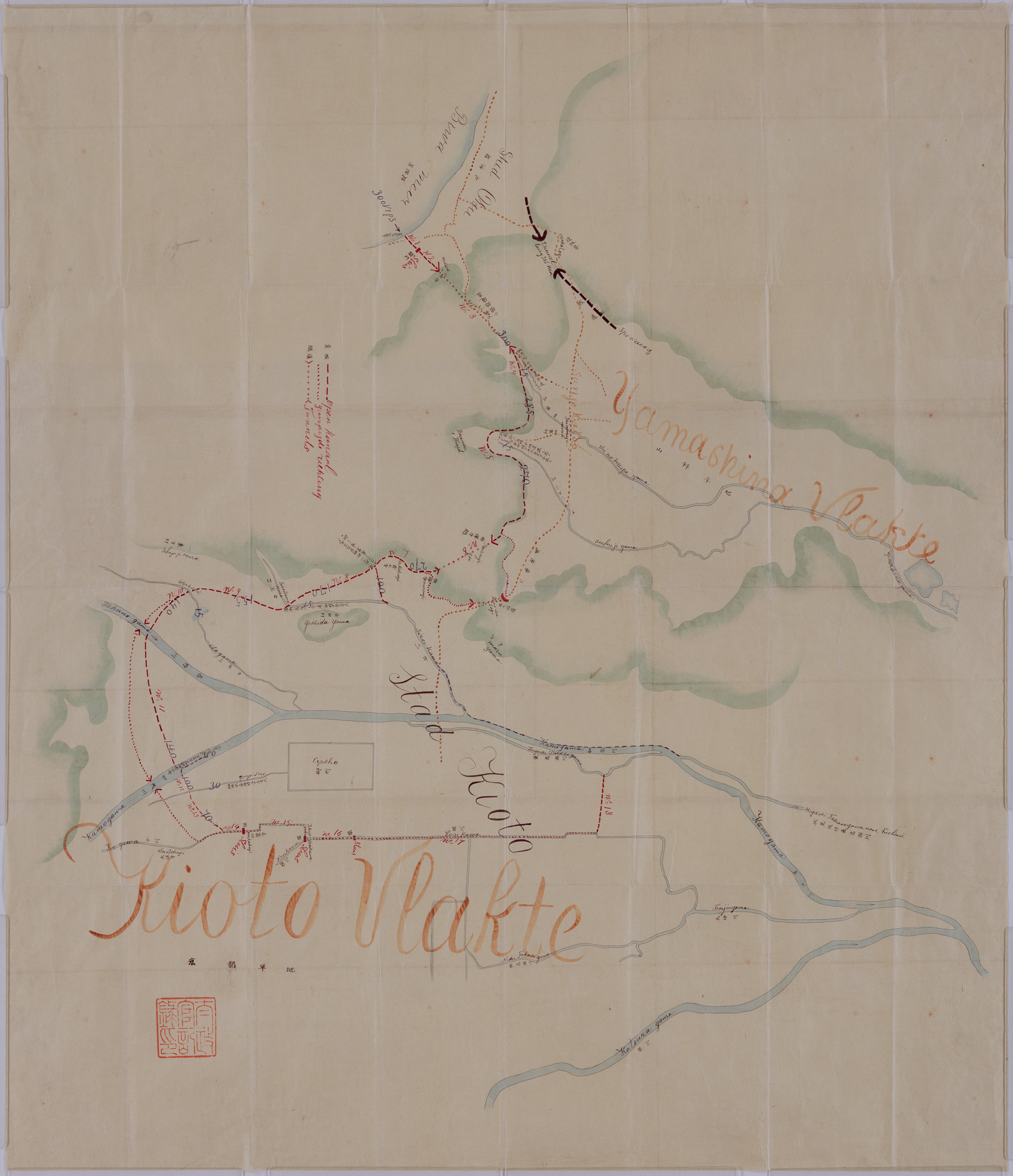
Biwakososuikoshi, fukumeisho, Fuzokuzu (Survey Map of Biwako Sosui Canal, No.1)
In November, the 16th year of Meiji(1883), Kyoto Prefecture submitted a request to start a canal project for Lake Biwa. Based on a fact-finding by de Rijke, a foreign national employed by the Ministry of the Interior, the ministry presented design made by Civil Engineering Bureau of the ministry, doubling the construction works budget estimated by Kyoto Prefecture, by reinforcing weak construction method. The ministry instructed at a joint meeting of Kamigyo and Shimogyo Wards of Kyoto to decide in favor of the plan presented by Civil Engineering Bureau of the ministry. Payment of construction expenses for preventing droughts that occurred in neighboring Osaka and Shiga Prefectures was also taken up as a problem. An increase in works expenses was approved at the joint meeting of the two wards and start of the construction was approved in January, 1885. "Kobun Fuzoku no Zu" (Picutures and charts affiliated with Kobun Roku) containing this diagram were designated as National Important Cultural Propertie of Japan in the 10th year of Heisei(1998) together with "Kobunroku" (Compiled Records of the Grand Council of State).
This is a map attached to "Report on Tunnels Between Lake Biwa and Kyoto" submitted on February 23, 1884, by Johannis de Rijke to director general, Civil Engineering Bureau, Ministry of the Interior.
Original size: 99cm and 86cm.
二次利用について:
ただし、画像については「画像等データの二次利用について」をご確認ください。