- Constitution
- Important Cultural Properties - Documents
- Important Cultural Properties - Classic Maps
- Important Cultural Properties - Japanese Classics
- Important Cultural Properties - Chinese Classics
- Various Holdings
- Genroku Kuniezu
- Genroku Gocho
- Tempo Kuniezu
- Tempo Gocho
- Shoho Shiroezu
Tempo Kuniezu
The Tokugawa Shogunate ordered four times in years of Keicho, Shoho, Genroku and Tempo to prepare maps of every "kuni" (country) all over Japan. Preparation of Genroku Kuni Ezu (national land maps) was ordered to be started in the 9th year of Genroku (1696) and completed to cover most of Japan by the 15th year of Genroku (1702).Preparation of Tempo Kuni Ezu was ordered in the 6th year of Tempo (1835) and completed in the 9th year of Tempo (1838). The mapping scale is 1: 21,600 approximately or 1 "sun" (3.3 cm) to 1 "ri" (4 km). Mountains, rivers and roads etc. are drawn on the maps. Black dots along main roads show mile stones. Counties are shown in different colors and an elliptic frame is attached to every village, in which name of village and a yield of rice are written. Box-shaped blank is attached to every castle town and names of city and castellan are written in the blank. Legends showing colors of counties, yield of rice in the counties, number of villages in the counties are labeled at a corner of each map. Names of officials conducted the preparation of maps are also written under the legends. Grid lines are drawn on some of the maps. Land Survey Department reproduced the Kuni Ezu for preparation of new national maps. These maps were used for practical purposes after the Meiji Restoration.The National Archives preserves eight originals and eight reproductions of Genroku Ezu, 83 national maps (119 sheets including duplication) and 12 reduced maps of Tempo Kuni Ezu. These maps and 85 Tempo Go Cho (records of villages) where a yield of rice of every village from Matsumae (Hokkaido) to Ryukyu (Okinawa) is recorded were designated as National Important Cultural Properties in the 58th year of Showa (1983). Tempo Kuni Ezu is drawn on high-quality drawing paper and the map sheets are very thick with multi-layered backing. There are wrinkles and thin spots on the surface caused by folding. The photography was carried out without any modification of the present conditions of the maps, and some of the portions may not be so clear.
- Select the region:Hokkaido
- Select the region:Tohoku
- Select the region:Kanto
- Select the region:Chubu
- Select the region:Kinki
- Select the region:Chugoku
- Select the region:Shikoku
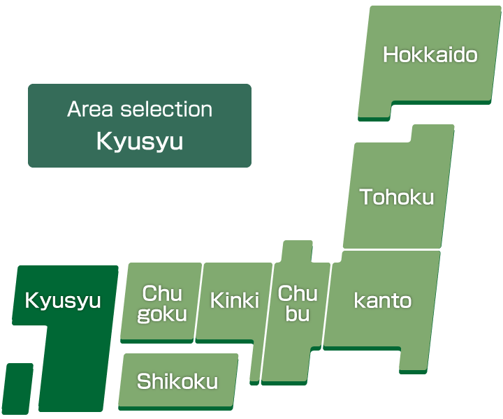
- Select the region:Kyusyu
List
-
Chikuzen-no-Kuni
"Nakasu" (holm) can be found at the estuary of Naka-gawa River, which connects with Hakata and Fukuoka Cities by bridges. Across the sea, Shika-no-shima, an island known for the discovery of golden seal, "Kinin," in the Island is placed beyond Umi-no-nakamichi. Original sizes: 413 cm from east to west and 346 cm from north to south.
-
Chikugo-no-Kuni
Land reclaimed by drainage widely stretches on coast of Ariake Sea. Original size: 318cm from east to west and 322cm from north to south.
-
Buzen-no-Kuni
Original size: 310cm of east and west and 322cm of north and south.
-
Bungo-no-Kuni
Original size: 519cm of east and west and 532cm of north and south.
-
Iki-no-Kuni
Original size: 186cm of east and west and 186cm of north and south.
-
Tsushima-no-Kuni
Original size: 170cm of east and west and 346cm of north and south.
-
Hizen-no-Kuni
The Goto Islands are drawn in the westward sea though the distance is not accurately proportioned. Volcano Fugen-zan or Fugen-dake, which erupted some hundred years later from the time of this map drawn, can be identified on the map. Original sizes: 711 cm from east to west and 532 cm from north to south.
-
Higo-no-Kuni
Original size: 609cm of east and west and 561cm of north and south
-
Hyuga-no-Kuni
Original size: 419cm of east and west and 709cm of north and south.
-
Ohsumi-no-Kuni
Original size: 353cm of east and west and 735cm of north and south.
-
Satsuma-no-Kuni
Sakurajima, presently a part of Osumi-hanto Peninsula is painted as an isolated island. Original sizes: 367 cm from east to west and 768 cm from north to south.
-
Ryukyu-koku (Okinawatou)
Shuri Castle is painted in a box-shaped blank in the southern part of Okinawa Island. Shallows and tideland called "Ino" surrounded by coral reef are painted in the central part of Okinawa Island. Original sizes: 320 cm from east to west and 543 cm from north to south.
-
Ryukyu-koku (Ohshima)
Islands of Amami-Oshima, Kikai-ga-shima, Toku-no-shima, Erabu-jima and Yoron-to presently belong to the Kagoshima Prefecture. However, these islands were part of the Kingdom of Ryukyu when the map was drawn. Original sizes: 315 cm from east to west and 575 cm from north to south.
-
Ryukyu-koku (Yaeyamatou)
"Yabishi," a legendary great coral reef with an area of 1.5 "ri" (6 km) from east to west and 5 "ri" (20 km) from north to south, which is said to appear every March the 3rd of lunar calendar, is depicted in the sea, north of Miyako-jima Island. Original sizes: 261 cm from east to west and 566 cm from north to south.