- The Digital Archives Top
- Various Holdings
- Maps, Drawing etc
- Shoho nenchu Edo ezu
- Shoho nenchu Edo ezu
Shoho nenchu Edo ezu
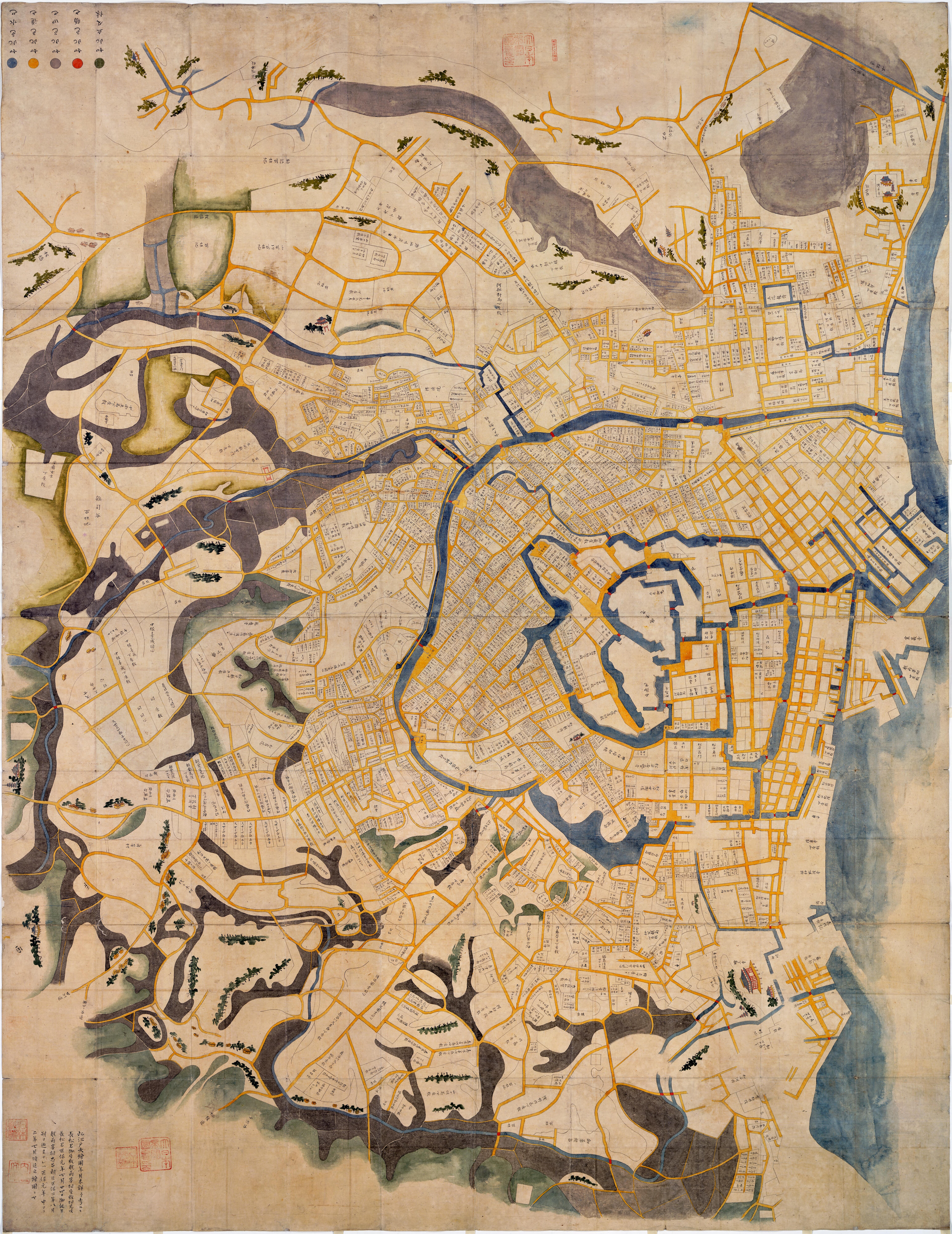
The map was reproduced in the 6th year of Kaei (1853), last period of Tokugawa Shogunate. It is estimated that the map shows the city of Edo (present Tokyo) in the first or second year of Shoho (1644 or 1645). This is a valuable map that enables us to see the features of Edo, capital of Japan before destroyed by Meireki Fire Disaster (1657). In the map, hills and forests are painted in green, paddy field in gray, roads in yellow and bridges in red. Those parts painted blue indicates sea, river or moat.Ryogoku-bashi Bridge, built after the Fire Disaster, naturally does not appear on the map. Nishi Hongan-ji Temple is placed in Hama-cho where it was located before being moved to Tsukiji, Higashi Hongan-ji Temple is depicted outside of Sujikai-mon, as before moved to Asakusa. Senso-ji Temple is at the east corner of the map and Zojo-ji Temple at the south corner, but a place where Gokoku-ji Temple is to be built later is labeled "official herb garden".
Original sizes: 201cm from east to west and 261cm from north to south.
二次利用について:
ただし、画像については「画像等データの二次利用について」をご確認ください。